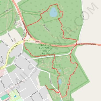
Whipstick Gully and New Zealand Hill loop hike
- Distance: 3.7 Km
- Elevation gain: 55 m
- Maximum elevation: 81 m
- Elevation loss: 60 m
- Minimum elevation: 37 m
- Moving time: 1 h 3 m
- Moving speed: 3.5 Km/h
- Maximum speed: 6.4 Km/h
- Total time: 1 h 31 m
- Global speed: 2.4 Km/h
Interactive trail map
Trail profile
- Distance: 3.7 Km
- Elevation gain: 55 m
- Maximum elevation: 81 m
- Elevation loss: 60 m
- Minimum elevation: 37 m
- Moving time: 1 h 3 m
- Moving speed: 3.5 Km/h
- Maximum speed: 6.4 Km/h
- Total time: 1 h 31 m
- Global speed: 2.4 Km/h
About this trail
Name: Whipstick Gully and New Zealand Hill loop hike trail, distance, elevation, map, profile, GPS track
Start: Hall Road, Foster, Victoria, 3960, Australia (-38.65466 146.21082)
End: 26, Landy Road, Foster, Victoria, 3960, Australia (-38.65397 146.20921)
Coordinates: -38.65518 146.20631 -38.64540 146.21352
Other hiking, mountain biking, running and outdoor activity trails
Click on a trail to view its statistics, map and profile.
Wilsons Promontory - Yarram
Australia > Victoria > Yanakie
#Bike
Distance: 71.4 Km • Elevation gain: 360 m • Maximum elevation: 66 m