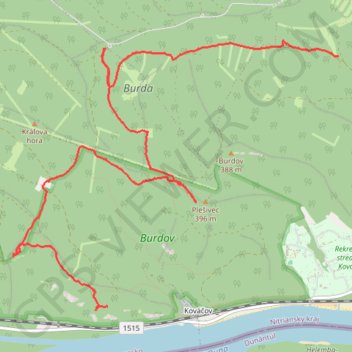
Jelenlegi nyomvonal: 23 SZE 2016 10:34
- Distance: 8.6 Km
- Elevation gain: 291 m
- Maximum elevation: 383 m
- Elevation loss: 275 m
- Minimum elevation: 213 m
- Moving time: 2 h 2 m
- Moving speed: 4.2 Km/h
- Maximum speed: 8.8 Km/h
- Total time: 3 h 49 s
- Global speed: 2.9 Km/h
Interactive trail map
Trail profile
- Distance: 8.6 Km
- Elevation gain: 291 m
- Maximum elevation: 383 m
- Elevation loss: 275 m
- Minimum elevation: 213 m
- Moving time: 2 h 2 m
- Moving speed: 4.2 Km/h
- Maximum speed: 8.8 Km/h
- Total time: 3 h 49 s
- Global speed: 2.9 Km/h
About this trail
Name: Jelenlegi nyomvonal: 23 SZE 2016 10:34 trail, distance, elevation, map, profile, GPS track
Coordinates: 47.82388 18.75941 47.84504 18.79749