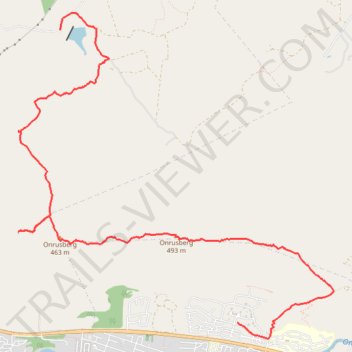
Onrusberg Ridge
- Distance: 10.9 Km
- Elevation gain: 529 m
- Maximum elevation: 487 m
- Elevation loss: 584 m
- Minimum elevation: 48 m
- Moving time: 2 h 40 m
- Moving speed: 4.0 Km/h
- Maximum speed: 11.6 Km/h
- Total time: 4 h 50 m
- Global speed: 2.2 Km/h
Interactive trail map
Trail profile
- Distance: 10.9 Km
- Elevation gain: 529 m
- Maximum elevation: 487 m
- Elevation loss: 584 m
- Minimum elevation: 48 m
- Moving time: 2 h 40 m
- Moving speed: 4.0 Km/h
- Maximum speed: 11.6 Km/h
- Total time: 4 h 50 m
- Global speed: 2.2 Km/h
About this trail
Name: Onrusberg Ridge trail, distance, elevation, map, profile, GPS track
Coordinates: -34.40804 19.15513 -34.37294 19.19638
Topography: Overstrand Local Municipality topographic map, elevation, terrain