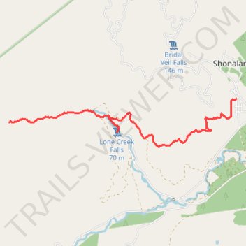
Fanie Botha Ceylon Hut to Maritzbos Hut via Lone Creek Falls
- Distance: 9.6 Km
- Elevation gain: 438 m
- Maximum elevation: 1,294 m
- Elevation loss: 229 m
- Minimum elevation: 1,069 m
- Moving time: 2 h 19 m
- Moving speed: 4.1 Km/h
- Maximum speed: 6.4 Km/h
- Total time: 2 h 37 m
- Global speed: 3.7 Km/h
Interactive trail map
Trail profile
- Distance: 9.6 Km
- Elevation gain: 438 m
- Maximum elevation: 1,294 m
- Elevation loss: 229 m
- Minimum elevation: 1,069 m
- Moving time: 2 h 19 m
- Moving speed: 4.1 Km/h
- Maximum speed: 6.4 Km/h
- Total time: 2 h 37 m
- Global speed: 3.7 Km/h
About this trail
Name: Fanie Botha Ceylon Hut to Maritzbos Hut via Lone Creek Falls trail, distance, elevation, map, profile, GPS track
Coordinates: -25.10555 30.68137 -25.09434 30.74020
Topography: Thaba Chweu Local Municipality topographic map, elevation, terrain
Other hiking, mountain biking, running and outdoor activity trails
Click on a trail to view its statistics, map and profile.
Fanie Botha Maritzbos Hut to Stables Hut
South Africa > Mpumalanga > Ehlanzeni District Municipality > Thaba Chweu Local Municipality
Distance: 12.5 Km • Elevation gain: 891 m • Maximum elevation: 1,949 m