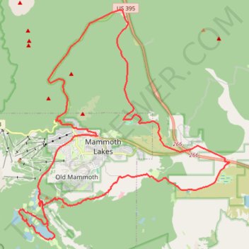
Gravel bike ride around Mammoth Lakes
- Distance: 54.4 Km
- Elevation gain: 1,038 m
- Maximum elevation: 2,739 m
- Elevation loss: 1,038 m
- Minimum elevation: 2,186 m
- Moving time: 3 h 27 m
- Moving speed: 15.7 Km/h
- Maximum speed: 70.8 Km/h
- Total time: 4 h 21 m
- Global speed: 12.5 Km/h
Interactive trail map
Trail profile
- Distance: 54.4 Km
- Elevation gain: 1,038 m
- Maximum elevation: 2,739 m
- Elevation loss: 1,038 m
- Minimum elevation: 2,186 m
- Moving time: 3 h 27 m
- Moving speed: 15.7 Km/h
- Maximum speed: 70.8 Km/h
- Total time: 4 h 21 m
- Global speed: 12.5 Km/h
About this trail
Name: Gravel bike ride around Mammoth Lakes trail, distance, elevation, map, profile, GPS track
Coordinates: 37.59875 -119.01729 37.70866 -118.89063
Other hiking, mountain biking, running and outdoor activity trails
Click on a trail to view its statistics, map and profile.
Mammoth to Bridgeport
United States > California > Mono County > Mammoth Lakes
Northern California Backcountry Discovery Route (CABDR-North)
Distance: 152.5 Km • Elevation gain: 2,191 m • Maximum elevation: 2,822 m